|
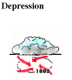
Once a group of thunderstorms has come together under the right atmospheric conditions for a long enough time, they may organize into a tropical depression. Winds near the center are constantly between 20 and 34 knots (23 - 39 mph). |
A tropical depression is designated when the first appearance of a lowered pressure and organized circulation in the center of the thunderstorm complex occurs. A surface pressure chart will reveal at least one closed isobar to reflect this lowering.
![[Image: (73K)]](/guides/mtr/hurr/stages/gifs/td2.gif)
Image provided by TPC
When viewed from a satellite, tropical depressions appear to have little organization. However, the slightest amount of rotation can usually be perceived when looking at a series of satellite images. Instead of a round appearance similar to hurricanes, tropical depressions look like individual thunderstorms that are grouped together. One such tropical depression is shown here.
|
stages |
|
tropical storm |