
|


Photograph by: Moller
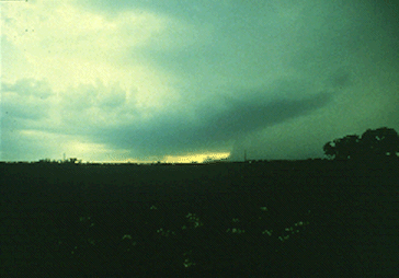
This is an extreme microburst event in a supercell storm, looking west. Although no wall cloud was present, baseball hail was occurring in the precipitation shaft on the right, with a rotating updraft base in the center of the photograph. A very rapid right to left movement was visible with the rain foot. "Guesstimations" were that winds were above 80 MPH in the microburst.
Photograph by: Moller
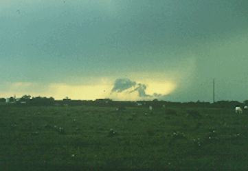
A telephoto view of the previous microburst shows that although there was not a full rain foot curl, there was a curl of scud clouds above the diminishing rain foot. The microburst probably was peaking or had just peaked when this photograph was taken. Remember, supercell severe weather, tornado or otherwise, often is the most violent of thunderstorm phenomena.
|
developing rain shaft |
|
Outflow Phenomena |