|
Effects of Snow Cover
on forecasted temperatures
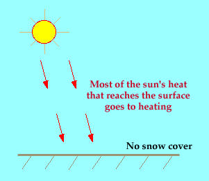
As the sun's rays hit the surface of the earth, much of it is
absorbed by the surface (as in the diagram below). This in turn
warms the air near the earth's surface, causing the temperature to rise.
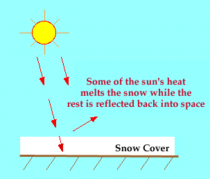
If there is snow on the ground, some of the sun's energy will be
reflected away by the snow, and some of it will be used to melt the snow.
This means that there is less energy available to heat the earth's surface
and consequently, the temperatures rise more slowly than would
occur with no snow on the ground.
Forecast Tip:
When snow cover is present, forecast lower daytime
temperatures than you would normally predict if there was no snow cover.
At night, snow on the ground readily gives off heat. This causes
rapid cooling. Forecast the overnight temperature to be lower than you
would predict if there was no snow cover.

temp advection
|
|

wind
|
|