|
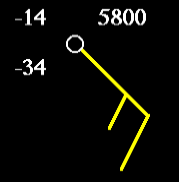
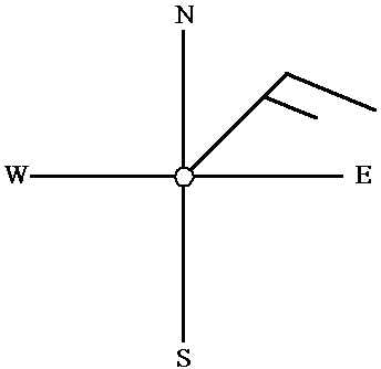
The symbol highlighted in yellow (in the diagram above) is known as a "Wind Barb". The wind barb indicates the wind direction and wind speed.
Wind barbs always point in the direction the wind is blowing "from". As is the case of the diagram below, the orientation of the wind barb indicates winds from the Northeast.
 Terminology:
The term "easterly" means that the winds are from the east, as in the example above. So if you hear someone say, "Generally easterly winds are found across much of the state of... ", they are describing winds from the east.
On the otherward, winds blowing in an "eastward" direction are winds that are blowing towards the east (from the west).
Wind speed is given here in the units of "knots" (knt). A Knot is a nautical mile per hour.
1 Knot = 1.15 Miles per Hour (mi/hr)
1 Knot = 1.9 Kilometers per Hour (km/hr)
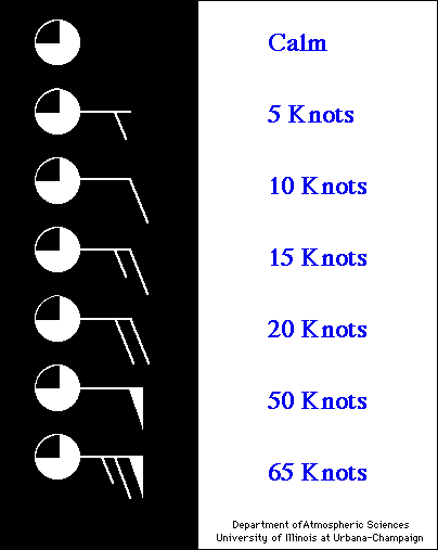
Using the table below, each short barb represents 5 knots, while each long barb represents 10 knots. A single long barb and a short barb is 15 knots, simply by adding the value of each barb together (10 knots + 5 knots = 15 knots).
Pennants are 50 knots. Therefore, the last wind barb in the chart below has a wind speed of 65 knots. (50 knots + 10 knots + 5 knots). If only a station circle is plotted, the winds are calm.
|
Height |
|
300 winds & heights |