|
Locating a Target
angles and distances used
The radar needs 3 pieces of information to determine
the location of a target.
|
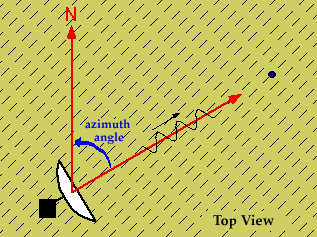
The first piece of information is the angle
of the radar beam with respect to north; called the
"azimuth angle". |
 |
|
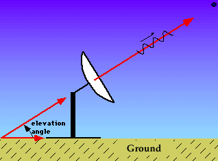
The second is the angle of the beam with respect to the ground; called
the "elevation angle". |
|
The third piece of information needed is the distance
(D) from radar to target.
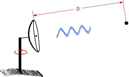
Distance is determined by measuring the time it takes for
the pulse to make a round trip from the radar to the target and back
using the relation
distance = (time) * (velocity). The velocity is the speed of light,
the speed at which the pulse travels (c).
Since the pulse has to travel to the target and back, the total distance
is 2D. If t is the time it takes, then
2D = ct or D = ct/2.
Using the calculated distance, azimuth angle and elevation angle, the exact
location of the target can be determined.

clear air returns
|
|

scanning modes
|
|