|
Winds Around Cyclones
flowing counterclockwise in the northern hemisphere
Wind barbs are useful for locating
low pressure centers on surface weather maps.
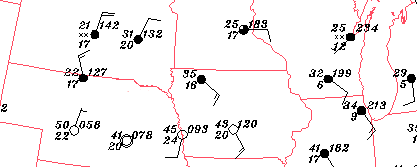
Since winds flow in a counterclockwise direction around
low
pressure centers, look for a group of stations where the
wind barbs
reflect this type of wind pattern.
For example, a counterclockwise wind pattern was observed
in the states of Nebraska, Iowa, Minnesota and South Dakota (highlighted by the
red arrow).
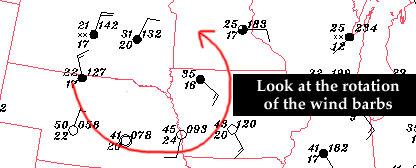
The low pressure center
was located near the center (similar to the center of a whirlpool) with winds
flowing counterclockwise around it.
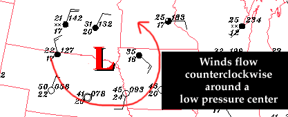
So when trying to find a low pressure center
on a surface weather map, use the wind
barbs to identify a counterclockwise wind pattern and
the low pressure center will be found near the center of circulation.

definition
|
|

air masses
|
|