|
|
. |
Rain or Snow?
what determines the precipitation type
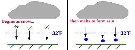
Most precipitation that reaches the ground actually begins as snow
high in the atmosphere. These snow flakes develop somewhere
above the freezing level
where the air temperature is less than 32 F (the dashed blue line),
and begin to fall toward the earth as snow.
If ground temperature is above 32 F,
the freezing level must be located somewhere above the ground.
The falling snow passes through the freezing level
into the warmer air, where it
melts and changes to rain before reaching the ground.
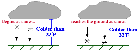
When the air temperature at the ground is less than 32 F,
the snow flakes do not melt on the way down and therefore reach the
ground as snow. This is why cold air is crucial for snowfall to occur.
Once in a while, snow will reach the ground eventhough the temperatures
outside are above freezing.
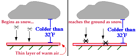
This occurs when a very thin layer of
warm air is found near the surface with temperatures several
degrees above freezing. However, since the layer of warm air is so shallow,
the precipitation reaches the ground as snow before it has a chance to melt and
become rain. This is how snow falls when the surface temperatures are above
freezing.
|