|
Midlatitude Cyclones
scaffolding activity teacher's guide
1) "a low pressure center."
2) By a red "L".
3) Cloudy with possible precipitation.
4) Comma-shaped configuration of the cloud bands.
The clouds resemble a giant comma, and the spin counterclockwise around the
cyclone center (in the northern hemisphere).
5)
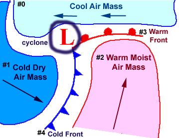
6) Winds flow generally in a counterclockwise
direction around the center of low pressure (in the northern
hemisphere).
7)
8) North-northeast.
9)
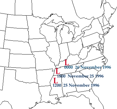
Map #1: Mississippi
Map #2: Tennessee
Map #3: Kentucky
10) Working with current weather data, so
no answer key available.

precipitation
|
|

universal time coord
|
|