
|


|
This aritcle was first published by NCSA Access
Magazine on March 9, 1999. It has been reproduced with permission.
All rights reserved. Do not copy or redistribute in any form. NCSA Access ©1999 Board of Trustees of the University of Illinois. |
 |
|
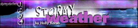
| Severe storms often batter one neighborhood
and leave an adjacent one unscathed. Will new forecasting models predict
which neighborhoods these storms will strike?
On April 3 and 4, 1974, lines of thunderstorms east of the Great Plains unleashed 148 tornadoes. This outbreak was the largest and most violent in U.S. history. Winds exceeded 261 miles per hour. Hail pummeled young crops and shattered glass. Three hundred fifteen people in 11 states were killed; 6,172 were injured. Hardest hit was Xenia, OH, where a tornado cut a half-mile wide swath through the center of town. Winds tossed a school bus through the wall of the high school gymnasium and onto the stage only minutes after students rehearsing a spring musical had fled.
Droegemeier, now a professor of meteorology and director of the Center for Analysis and Prediction of Storms at the University of Oklahoma, wants to stretch severe storm warning time from minutes to hours. And he wants to predict where a storm will strike to within a few miles. "We want to be able to say that from 3:30 to 3:45 this afternoon a line of thunderstorms will pass over the airport with 50 mile-per-hour winds. And we want to be able to tell you this at 11 o'clock in the morning," says Droegemeier.
Such pinpoint predictions are still years away. But in the quest to refine forecasts from the nation to the neighborhood, Droegemeier's team is leading the pack. In January they unveiled a new version of their Advanced Regional Prediction System (ARPS) during the annual meeting of the American Meteorological Society in Dallas, TX. Using all 128 processors of an SGI CRAY Origin2000 at NCSA, Droegemeier's team generated daily real-time forecasts at resolutions of 32 km, 9 km, and 3 km. A 3-km resolution is equivalent to predicting the weather at points 12 city blocks apart. "Droegemeier's model will provide more information about an impending storm," says Mike Fritsch, a professor of meteorology at Penn State University. "It will give you more accurate estimates of the timing, location, and properties of a given storm system; for example, whether or not there are going to be thunderstorms and if they are likely to be severe. In other words, it is a sharper window on weather. That's a substantial step forward."
|
|
 Kelvin Droegemeier was only 16 at the time but he remembers how these storms
struck with almost random devastation. Some 490,000 square miles were threatened
by the storms yet only 600 were actually damaged by violent winds. What
triggered the formation of a storm in one place and not another? Why in
Xenia and not 10 miles to the south? Had meteorologists had answers to
these questions in 1974, residents of Xenia may have had more than 11 minutes
of warning.
Kelvin Droegemeier was only 16 at the time but he remembers how these storms
struck with almost random devastation. Some 490,000 square miles were threatened
by the storms yet only 600 were actually damaged by violent winds. What
triggered the formation of a storm in one place and not another? Why in
Xenia and not 10 miles to the south? Had meteorologists had answers to
these questions in 1974, residents of Xenia may have had more than 11 minutes
of warning.
|
Parameters |
|
figure 1 |