
|


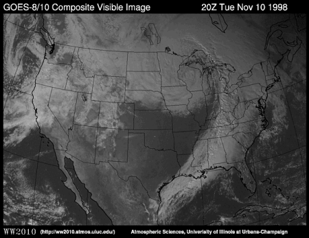
Visible satellite images are photographs of the earth that provide information about cloud cover. Areas of white indicate clouds while shades of gray indicate generally clear skies. In the example below (a composite of data from GOES-8 and GOES-10 satellites), scattered clouds are found across much of the eastern United States with clearer skies from North Dakota south to Oklahoma.
Visible images represent the amount
of sunlight being scattered back into space
by the clouds, aerosols, atmospheric gases, and the Earth's surface.
Thicker clouds have a higher reflectivity (or albedo) and
appear brighter than thinner clouds on a visible image.
However, it is difficult
to distinguish among low,
middle, and
high level
clouds in a visible satellite image, since they
can all have a similar albedo
and for this distinction,
infrared satellite images are useful.
|
POES Satellites |
|
infrared (ir) |