
|


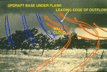
A few HP storms do produce violent tornadoes. When they occur, the tornadoes often will be wrapped in precipitation and quite difficult to observe. The photographer heard a roaring sound, and ran outside where he had this westward view. Behind the super-imposed inflow arrows is a wall cloud, with a rain area and RFD wrapping from left to right around the wall cloud's southeast flank. This rain shaft is visual manifestation of the radar hook (an unusually "fat" radar hook in this case) wrapping around the wall cloud and developing tornado.
Photograph by: NSSL
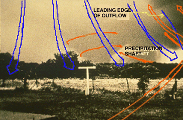
We are in a position of strong inflow, as noted by the northward-bending trees (in the image below). However, a gust front (blue, descending arrows) is accompanying the precipitation and approaching the photographic position. The brunt of the HP storm's precipitation area is out of the photo and to the right (northeast of the wall cloud).

Photograph by: NSSL
Still hearing a roaring sound, the photographer shifted his view a bit towards the northwest. Almost hidden behind the advancing rotating rain curtain is a large and devastating tornado!
Photograph by: NSSL
The rain curtains that wrap around an HP supercell's tornado often change very quickly in appearance. Minutes later, the tornado is not quite as obscured by the precipitation. View these three slides a second time and observe the advance of the rain curtain and gust front. The tornado was continuing to receive a narrow corridor of inflow from the northeast at this time, as it approached Drumwright, Oklahoma. Fourteen people were killed by this violent 1974 tornado.
|
westward view |
|
outflow boundary |