
|


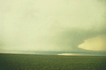
Heavy precipitation supercells have some identifiable radar features, including "broad hooks" and/or large inflow notches on the east and southeast storm flank. A lemon technique tilt sequence will indicate a weak echo region (WER), overhang, and highest top in alignment on the leading flank. These storms will be quite difficult for spotters to handle because of both the lack of contrast between the updraft and surrounding rainy-downdraft areas, and lack of past training about these storms.
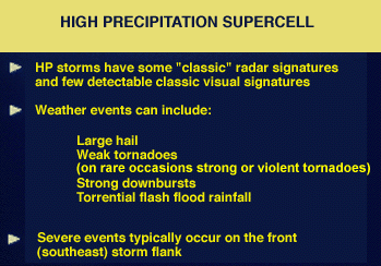
HP supercells are prolific flash flood producers, and this threat should not be overlooked in light of the other severe weather elements being reported with such a storm.
Photograph by: NWS
An HP storm in Fort Worth, Texas, produced almost 5 inches of rain within one hour, with most of the rain falling within 45 minutes. Some indications are that HP storms might be somewhat more frequent in the southeast U.S., but they do occur in most areas east of the Rockies. Quite important to storm spotters and severe weather forecasters is that HP supercells probably account for many of the "tornado embedded in rain" events, a phenomenon that occurs not only in the southeast but elsewhere, including the High Plains.
|
introduction |
|
westward view |