
|


We are looking northeast from about 15 miles, along the axis of the flanking line into this multicell storm. Note the several "humps" of multicellular Cb top embedded in the anvil.
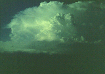
Photograph by: NSSL
The soft or glaciated appearance of the Cb tops and anvil suggests little chance for updraft-dependent severe weather with this storm, as these visual clues strongly suggest a relatively weak or diminishing updraft.
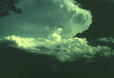
Photograph by: Doswell
This southeast view of another multicell storm, from about 12 miles, shows a much crisper appearing Cb top, with hard, cumuliform structure also seen in the anvil. Another clue that this is a strong updraft is the "back-sheared" anvil, overhanging the back flank of the right-to-left moving storm complex. This storm produced marginally-severe, one inch diameter hail in West Texas in 1977.
|
development |
|
life cycle |