
|


A multicell cluster storm, the most common of the four basic storm types, evolves as an organized sequence of cells in various stages of development and decay at any given time. When multicell storms form in environments with winds which veer from southerly to westerly and increase with height, new updraft development usually occurs in the upwind (usually southwest) quadrant of the complex, with older cells decaying in the downwind quadrant.
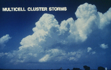
Photograph by: Doswell
The new development, called the flanking line, is at the left (southwest) side of the complex. The rain-free base disappears beneath the twin towers on the right-hand side of the photo, since precipitation is falling from these glaciated thunderstorm cells.
Glaciation refers to the transformation of cloud particles from water droplets to ice crystals. The visual cloud appearance often changes from rock-hard to soft during the glaciation process. The northeastward tilt of the multicell complex above indicates the presence of vertical wind shear (looking north from about 12 miles).
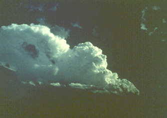
Photograph by: Doswell
Another multicell storm, this time looking south in an even more strongly sheared wind field. Precipitation is beginning to fall from the Cb top on the left (east) side of the complex. (Western Oklahoma storm, June 1980).
|
components |
|
perspectives |