|
Researchers have shown that wall clouds probably develop when some rain-cooled air is pulled upward, along with the more buoyant air, as the strengthening updraft attempts to replace ever-growing volumes of rising air. The rain-cooled air is very humid, and upon being lifted it quickly saturates to form the lowered cloud base. Thus, the wall and tail cloud probably develop sometime after an intense supercell or multicell storm begins to precipitate.
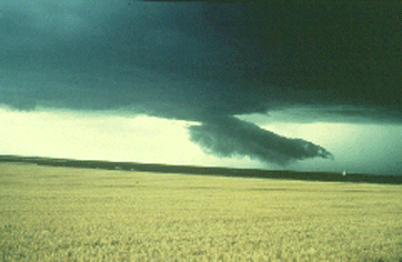
Photograph by: Moller
Looking to the northwest, we see a detached scud cloud which had just emerged from the precipitation area and was moving rapidly southwestward (from right to left).
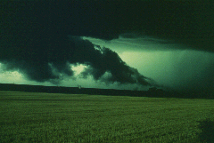
Photograph by: Moller |
About 5 minutes later, the scud cloud entered the updraft area and was lifted into the cloud base. This was the beginning of a wall and tail cloud that persisted for over 30 minutes. |
Look closely at the center of the photo and near the north end of the tail cloud. A small, tornadic dust whirl is visible. This tornado circulation was relatively weak, but strong enough to overturn a mobile home. It was beneath the tail cloud and not the wall cloud! Events such as this have been observed more than once.
Numerous observations of wall clouds indicate these following items to be the main delineating characteristics between tornadic and non-tornadic wall clouds. Tornadic wall clouds usually persist for "tens of minutes" prior to tornadogenesis, whereas non-tornadic wall clouds often don't persist as long.
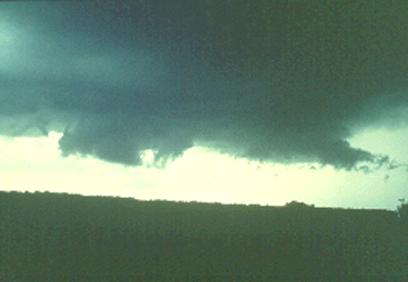
Photograph by: Moller
Tornadic wall clouds exhibit rapid and even violent rotational and vertical (predominantly ascending) motions, with non-tornadic wall clouds having less dramatic motions. Finally, tornadic wall clouds are characterized by strong, warm inflow from the southeast and east, usually much stronger inflow than that with non-tornadic storms. We will discuss these characteristics in more detail.
In review, tornadic wall clouds are persistent over tens of minutes, have surface-based inflow, and exhibit rapid rotational and vertical motions. Next we will view several non-tornadic wall clouds and discuss their "tornadic short-comings."

Outflow Phenomena |
|

beneath CB towers |


