
|


Here we have a southward view of a supercell, with precipitation in the right middle-ground and a wall cloud beneath the cumulonimbus (Cb) tower and anvil overhang in the background. The wall cloud produced a tornado within 30 minutes in southwest Oklahoma City.
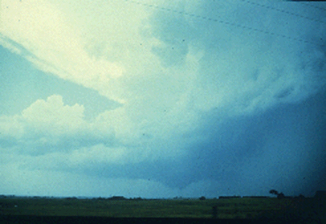
Photograph by: Doswell
Looking west from 5 miles away, note the supercell wall cloud. We have learned much about the nature of wall clouds in the last decade. For instance, persistent wall clouds signify a strong updraft which is capable of producing large hail, and if conditions are right, tornadoes. However, only a few cloud-base lowerings actually are wall clouds, and probably less than half of all legitimate wall clouds spawn tornadoes.
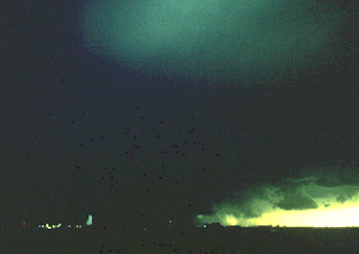
Photograph by: Doswell
This is not to minimize the importance of wall clouds, as they are a reasonable indicator of updraft strength. The most visually-impressive examples characteristically precede the most powerful tornadoes. This ominously dark wall cloud occurred with a very severe hailstorm and several weak tornadoes.
|
introduction |
|
short-lived |