
|


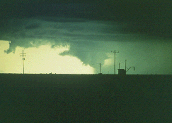
We are looking west at the south flank of a severe multicell storm that bordered on becoming a supercell at times. Some rotation and several wall clouds accompanied the bursts of large hail and microbursts with this southwest Texas storm.

Photograph by: Moller
A rain foot (below) was developing at this time, with rain-free base in the foreground and a small wall cloud southwest of the rain shaft.
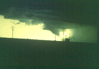
Photograph by: Moller
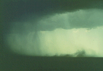
Several minutes later the rain foot was beginning to curl up towards the wall cloud. Even from this distance of about 10 miles, strong winds were evident from the motions of the laterally spreading precipitation.
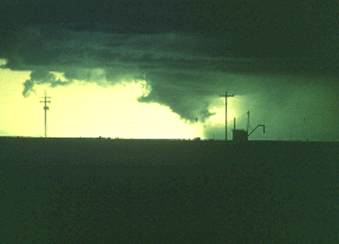
Photograph by: Moller
This seems to verify that a microburst is occurring, and also that many wall clouds likely result from an injection of rain-cooled air into the severe storm updraft.
Photograph by: Moller
This is not a tornado, but a microburst with precipitation being pulled into the wall cloud and updraft of the multicell storm.
Photograph by: Moller
Similar to the rain foot is a "dust foot," seen here spreading and curling upwards from left to right. An aircraft engaged in low-level operations should not venture into these rain or dust feet! Spotters should check out the area that has been affected (if possible) for any sign of damage. This was a multicell storm that also produced heavy rain and small hail.
|
scud clouds, virga |
|
Wall Clouds |