
|


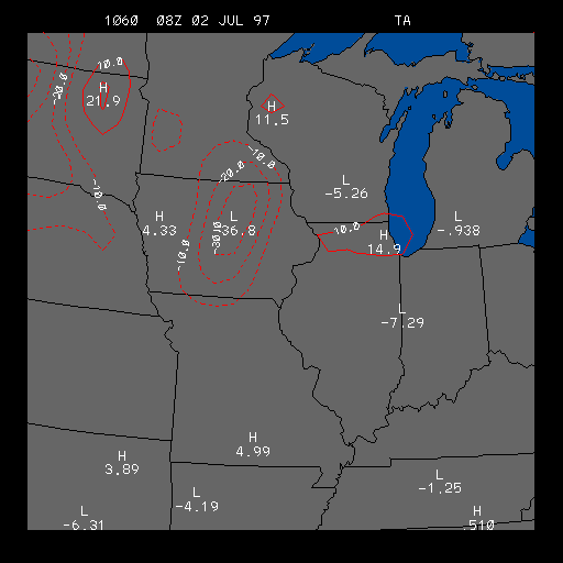
Example Surface Temperature Advection Image
This is the Surface Temperature Advection image which is useful for
finding regions of warm advection and
cold advection .
Warm advection regions are outlined in sold lines, while regions of cold advection are outlined in dashed lines. Both advection areas are contoured in intervals of 10 degrees Fahrenheit per day. That means a warm advection outline of 20 would indicate that if warm advection was to continue at the present rate for 24 hours, the temperature would increase by 20 degrees Fahrenheit.
Regions of temperature advection are useful for locating fronts; a warm front is characterized by a region of warm advection, and a cold front is characterized by a region of cold advection. In addition, these advection areas indicate regions of rising and sinking motions. Meteorologists know that warm advection can lead to rising motions and that cold advection can lead to sinking motions.
The example image above shows an area of strong cold advection centered on Iowa. This cold advection area is due to a cold front that was passing through Iowa at the time of this image. This image clearly shows how much colder the air was behind the cold front than ahead of the cold front.
|
moist. convergence |
|
dew point advect |