
|


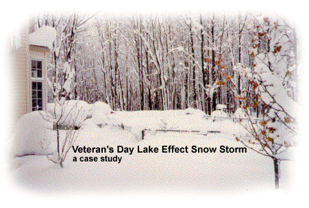
Photograph by: Emiel and Sylvie Bon; Chardon, Ohio.
The Veteran's Day storm of November 9-14, 1996 may be the most severe early season lake effect snow (LES) storm the Great Lakes has witnessed in the past fifty years. At the height of the storm, over 160,000 customers were without power in Greater Cleveland alone, as the storm produced isolated snowfall tallies approaching 70". As usual with these LES events, the Veteran's Day storm battered snowbelt communities downwind of each of the Great Lakes while nearby towns went unscathed. The following case study presents weather maps, images, photographs, text, and annotations that document the history and evolution of this storm. Much of the discussion focuses on NE Ohio, but regional and national analyses are included in the review.
| Sections
Last Update: 09/04/97 |
A Personal Perspective
Newspaper clippings, photographs and a detailed eyewitness log from those who endured the storm.
Data and Analysis
Advanced Topics
Acknowledgements
|
Heavy snowfall in Northeast Ohio is uncommon in early November, though notable exceptions have occurred as early as mid October. LES is usually the reason for these early season tastes of winter. Lake Erie's surface water temperatures may still be near 60 F, while inland surface temperatures fall well below freezing during cold air outbreaks. The cold air from Canada and points to the northwest is moisture-starved so great amounts of both heat and water vapor are drawn into these air masses as they traverse the Great Lakes. The strong temperature contrast between the lake and the polar or arctic air masses promotes turbulence and rising motions in the lower part of the air column which in turn produce clouds and precipitation.
If cold enough, this precipitation will fall as snow flurries, snow showers, or snow "squalls" (squalls indicates lake-effect snow which is more organized or intense). The squalls may persist for hours in favored locations to the lee of the lakes, resulting in the famous lake effect snowstorms we hear so much about. These favored locations are called the "snowbelts" and are generally found to the south and east of all of the Great Lakes. In northeast (NE) Ohio the primary snowbelt runs through the extreme NE corner of the state in Lake, Geauga, Ashtabula and the eastern part of Cuyahoga counties. A secondary snowbelt is composed of communities south of downtown Cleveland, where high elevation and the right wind direction can bring about heavy LES in Summit, Medina, Portage, and Trumbull counties.
The navigation menu (left) for this module is called "Veterans Day Snow" and the menu items are arranged in a recommended sequence, beginning with this introduction. In addition, this entire web server is accessible in both "graphics" and "text"-based modes, a feature controlled from the blue "User Interface" menu (located beneath the black navigation menus). More information about the user interface options, the navigation system, or WW2010 in general is accessible from About This Server.
|
Case Studies |
|
Personal Perspective |