
|


On Saturday November 9th, a vigorous upper-level disturbance or "shortwave" was pivoting into the eastern Great Lakes. The National Center for Environmental Prediction (NCEP) computer models forecast a modest surface low in western PA by the early morning of November 10th which was a response to the upper shortwave feature. The shortwave produces "positive vorticity advection" (PVA) which encourages rising motions and convergence near the surface which helped to spin-up the surface low and increase the threat of snowfall in Northeast Ohio on the morning of November 9th. Much of NE Ohio did begin to receive wet snow on Saturday morning despite surface temperatures in the mid and upper 30's. The intermittent snow of the daytime hours of November 9th became a widespread and steadier snowfall that night. The shortwave had slowed considerably as it neared the closed upper low in the St. Lawrence valley and became almost stationary in east central Ohio and western PA on the evening of the 9th. Surface winds were light northerly and northeasterly under the upper disturbance and this produced a wind flow over Lake Erie in northeast Ohio which may have enhanced the synoptic snowfall.
Snowfalls ranged from a dusting to 14" of snow that night in the snowbelt of Geauga, Summit, and Trumbull counties. Elevation played a crucial role in the snowfall distribution as can be seen in the snowfall totals; the higher elevations east and south of Cleveland received greater tallies due to their colder surface temperatures and the additional lift of the moist parcels moving almost due south from the lakeshore. The snow was very wet and heavy and there were isolated reports of thunder and lightning at the height of the storm. Communities just east and south of Cleveland, such as Lyndhurst, Shaker Heights, and Garfield Heights, were hard hit with widespread tree damage; power lines were downed by the falling trees and heavy sticky snowfall. By Sunday morning some 70,000 customers were without power. Many roads were blocked with downed trees and power lines, but the synoptic and lake-enhanced snows had ended.
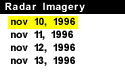
The radar image below suggests the counterclockwise swirl of the upper level vortex through its telltale comma shape of precipitation echoes. Notice, the over-water air trajectories into NE Ohio and the enhancement of radar reflectivity as the echoes move inland.

The center of the upper shortwave is clearly discernable near Youngstown, OH. In fact, little snow was received from this storm east of the Ohio-PA line. Buffalo, for example remained in warmer surface and upper level air throughout the nightime and recieved only intermittent rain mixed with snow.
The heavy lake effect snows, fast on the heels of this synoptic snowfall, would be especially troublesome to NE Ohio because of the wet snowfall on the evening of November 9th. The snow to water ratio was estimated, locally, at 7 or 8:1 during this part of the storm; this is compared to the subseqent lake effect snowfall which was measured in the range of 10-15:1 ratio of snow to water content. The tremendous accumulations of snowfall through Friday November 15th are especially noteworthy when one considers that typical lake effect snowfalls are often very dry with snow to water ratios of 20:1 or higher.
|
Snowfall Totals |
|
Nov 11, 1996 |