|

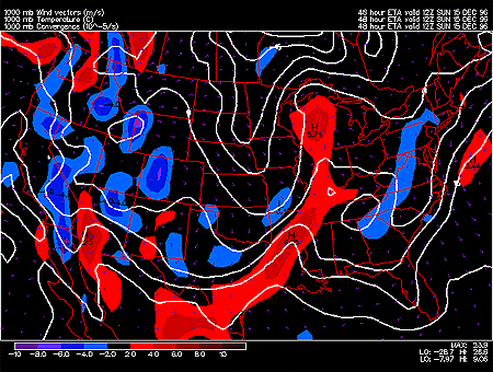
This panel shows 1000 mb forecasted fields for convergence, temperature and wind vectors. The solid white contours represent temperature in degrees Celsius with an interval of 5 degrees. The temperature field is useful for locating warm and cold air masses and associated surface fronts.
Wind vectors provide information about wind direction and wind speed and are drawn here as tiny white arrows. Wind vectors point towards the direction in which the wind is blowing and the longer the wind vector, the stronger the wind. The unit of magnitude for wind speed as depicted by the wind vectors is meters per second.
Convergence is represented by the color filled regions and the associated values are indicated by the color code located in the lower left corner of the forecast panel. Regions of convergence are shown in red and regions of divergence are shown in blue.
|
