
|


This supercell did produce tornadoes, six of them. About the time this photograph was taken, the last of the six tornadoes was occurring. From this vantage point about 20 miles north of the storm, near Itasca, Texas, we see a small portion of the rain-free base beneath the updraft area, but no tornado. Obviously, a spotter must have the right position relative to the storm to see tornadoes.
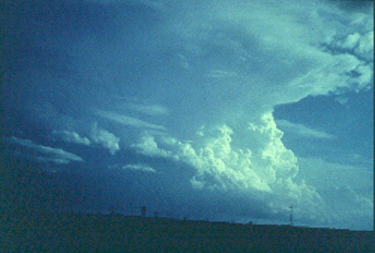
Photograph by: Moller
The same storm and its sixth tornado were photographed in a different location at about the time the last photo was taken. Looking northeast from 4 miles, we are on the other side of the precipitation seen in the last photo.
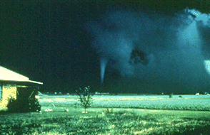
Photograph by: NWS
The left to right moving condensation funnel is partially illuminated by late afternoon lighting. Note the sharp-edged precipitation curtain on the right side. The combination of strong and adjacent vertical drafts often results in very heavy hail and rain curtains immediately downwind (usually northeast) of the updraft. Indeed, spotting position does make a difference, although the optimal view of a late afternoon supercell is not towards the northeast.
|
multicell to supercell |
|
Tstorm Components |