
|


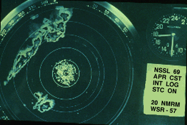
Supercells most frequently are isolated and often develop in the warm air ahead of a squall line. This supercell formed south-southwest of the radar site and produced large hail and tornadoes well ahead of a broken to solid squall line.
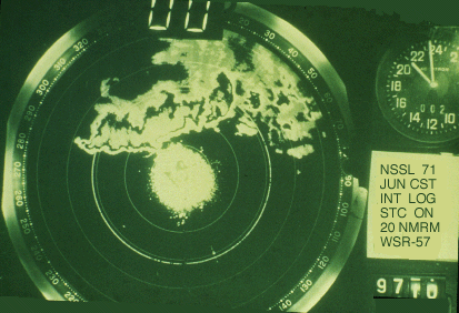
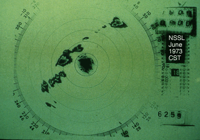
This supercell, north-northwest of the radar, developed within an east-west oriented solid squall line. It produced severe weather and funnel clouds, but no known tornadoes. Subjective experience suggests that such storms are not as likely to produce strong to violent tornadoes as are more isolated storms.
However, other evidence shows that storm spacing, which is necessary for significant tornado formation, is probably greater on the High Plains than that in the southeast U.S., possibly because of the abundant moisture near the Gulf of Mexico. Supercells frequently occur in "preferred" regions relative to other radar echoes. First, in this case of a scattered to broken line of thunderstorms, a supercell is evident due west of the radar site, positioned in a weakly-developed LEWP and north of a break in the line.
Surface data indicates that a small scale low pressure system, about 100 miles in diameter, probably accounted for the LEWP configuration. Supercells often form near or immediately northeast of such a low. The lack of other storms in the immediate vicinity of this supercell allowed the intense storm to produce tornadoes and large hail for several hours without interference. The slow-moving storm also produced flash flooding.
|
introduction |
|
schematic diagrams |