
|


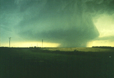
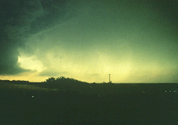
This was initially a small supercell, looking west from about 8 miles, that packed a very intense rotating updraft. The rain curtains extending beneath the storm base were rotating, and looked very much like the rain areas we have seen under HP supercell bases. Once again, note the vaulted appearance on the north (right) side of the updraft. The storm was producing baseball size hail at this time, and a low-pitched, subtle, and continuous roaring sound was heard. Storm chasers have heard this a number of times, particularly close to LP storms, and attribute it to hailfall.
Photograph by: Moller
Below is a northward view of the storm's main precipitation area. It has the nearly transparent look of an LP storm. The radar echo at this time showed a relatively small VIP 4 storm, although a small radar pendant was present. A VIP 4 with baseball hail! Indeed, it seemed to have mainly LP characteristics, except for the rotating rain curtains wrapping around the updraft base.
Photograph by: Moller
At this time and location, just west of Archer City, Texas, east surface winds were blowing into the supercell at 25 to 30 MPH. We are very close in position to the pseudo-warm front, separating cool outflow coming from this precipitation area to the north from warm air to the south...
|
Tornadoes |
|
tornado develops |