
|


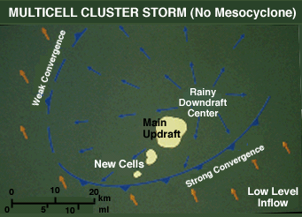
The difference between a non-tornadic thunderstorm
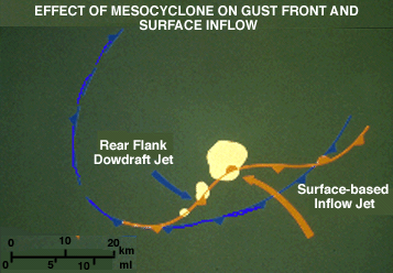
and a tornadic supercell is that the latter storm's vigorous rotation and surface low pressure field cause a wave to form on the gust front.
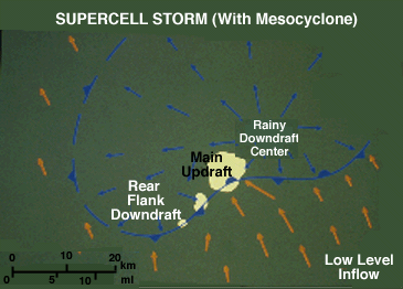
This allows warm, moist surface-based air to feed continually into the updraft and wall cloud. Cold air is "wrapped up" by the strong circulation and does not immediately undercut the wall cloud. Instead, the wall cloud becomes the location of extreme convergence of warm and rain-cooled air.
The two previous examples are combined for comparison's sake. If the "undercut" storm is a relatively weak supercell (rather than a severe multicell storm), then the circulation is not strong enough to prevent cold outflow undercutting.
|
Tornadoes |
|
mesocyclone |