
|


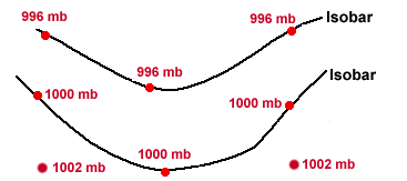
A line drawn on a weather map connecting points of equal pressure is called an "isobar". Isobars are generated from mean sea-level pressure reports and are given in millibars.
The diagram below depicts a pair of sample isobars. At every point along the top isobar, the pressure is 996 mb while at every point along the bottom isobar, the pressure is 1000 mb. Points above the 1000 mb isobar have a lower pressure and points below that isobar have a higher pressure.
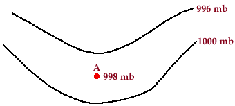
Any point lying in between these two isobars must have a pressure somewhere between 996 mb and 1000 mb. Point A, for example, has a pressure of 998 mb and is therefore located between the 996 mb isobar and the 1000 mb isobar.
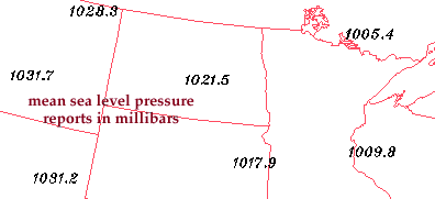
Sea-level pressure reports are available every hour, which means that isobar maps are likewise available every hour. The solid blue contours (in the map below) represent isobars and the numbers along selected contours indicate the pressure value of that particular isobar.
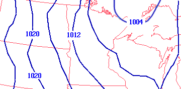
Such maps are useful for locating areas of high and low pressure, which correspond to the positions of surface cyclones and anticyclones. A map of isobars is also useful for locating strong pressure gradients, which are identifiable by a tight packing of the isobars. Stronger winds are associated with stronger pressure gradients.
|
variation with height |
|
pressure surfaces |