
|


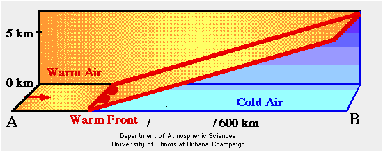
Soundings are the most important tool for identifying potential freezing rain regimes. Three types of soundings can lead to freezing rain and the most common consists of a shallow layer of cold air at the surface with a depth of about 600 meters (1,800 feet).
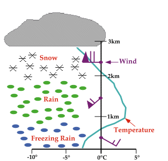
Above the cold air is a layer of warmer air with a depth of about 1,400 meters (4,200 feet). Winds near the surface are usually east or southeasterly, then veer around to the southwest in the warm air, and finally become westerly in upper levels. The sounding given above represents only an average case.
Animation by: Hall
For precipitation to form, something is needed to force the air to rise. Warm air overrunning is the most common process in the production of freezing rain. This occurs as warm air rides up and over colder air, (as in the animation above), the water vapor condenses, producing clouds and precipitation. When the precipitation falls through an atmosphere with a temperature profile similar to the one described above, freezing rain is a likely result.
|
precipitation type |
|
swrp sounding |