
|


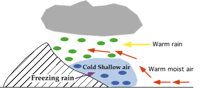
Cold-air damming is common along the East Coast of the United States and occurs when a layer of cold air gets trapped between the coast and inland mountains. Freezing rain develops when warm oceanic air rises up and over the cold air, producing liquid precipitation that falls through the cold layer. The falling droplets become supercooled and freeze on impact with the cold surface.
Another weather pattern that may lead to the development of freezing rain is a broad area of low pressure called an "extended low", which is typically very weak and covers a large area of the country. An extended low has very diffuse frontal boundaries and is often the remnants of a dying cyclone.
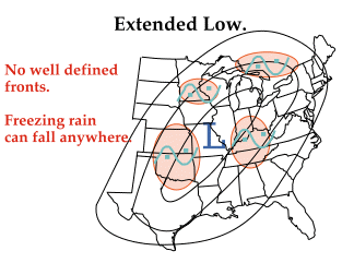
Upper-level winds transport warm moist air up and over the pool of cold air associated with the extended low, and given the right conditions, freezing rain occurs. In addition, convergence associated with the low produces upward motions that may also contribute to the development of freezing rain. Freezing rain can be found anywhere in the vicinity of an extended low since there are typically no preferred regions of development.
|
pressure features |
|
Forecasting |