
|


By early afternoon on November 12, 1996, temperatures remain slightly below freezing throughout the immediate Great Lakes region. A new feature on the surface analysis, is the leading edge of a surface high pressure ridge nosing into SW Illinois.
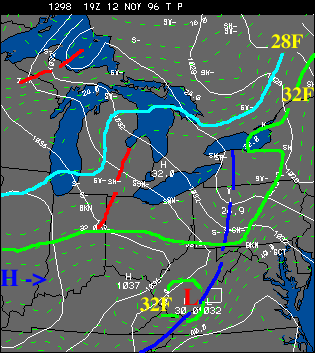 |
This is an early sign that the eastern trough and cold air are beginning a slow lift to the north and east. However, the lake effect squalls persist through Thursday afternoon into the eastern lakes, so the stabilizing and drying of the air mass anchored in this region is very slow to give up ground. |
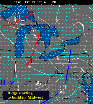
The thermal troughs are less pronounced on this date, especially east of Lake Michigan. The wind shift on either side of the trough axis is less and there is no sharp southward "kinking" of the isobars - which is a good way of identifying such features.
 |
Overall the flow is backing to a more westerly and WSW direction. Over Lake Erie this resulted in lake effect snowbands shifting slightly northward and moving up the shoreline towards Ashtabula county and NW Pennsylvania. The secondary snowbelt in NE Ohio, south of downtown Cleveland and eastward towards Youingstown, has stopped receiving much lake effect snow. |
Communities close to Lake Erie in Lake and Ashtabula county received their heaviest snowfall beginning in the late afternoon and into the nighttime hours - where again, the squalls intensify.
|
Nov 12, 1996 03z |
|
Nov 13, 1996 03z |