
|


With the unstable atmosphere and wind shear in place, there has to be a forcing mechanism to cause the upward motion necessary for thunderstorms to develop. For this, meteorologists keep an eye out for regions of strong moisture convergence.
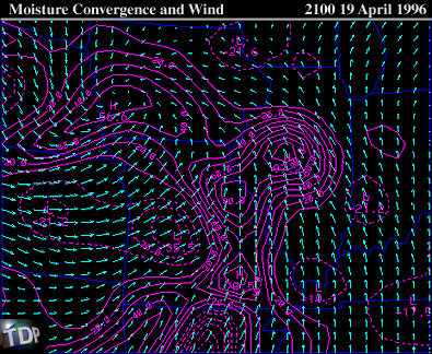 |
In the panel of surface winds (arrows) and moisture convergence (solid contours), a maximum in the moisture convergence field was observed over west-central Illinois and eastern Missouri. This is where the maximum convective forcing was occurring at 21Z, or 4:00 PM CDT and where thunderstorms were most likely to develop.
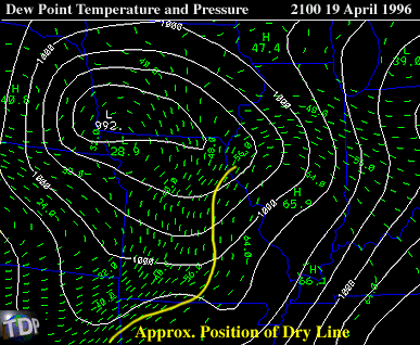 |
This area of convergence was aligned along the warm front in central Illinois and also preceded an advancing dry line moving through Missouri. The thunderstorms began to explode after 2100 UTC, or 4:00 PM CDT, in the region of maximum moisture convergence, just east of the dry line.
|
shear profile |
|
NEXRad Close-Ups |