|
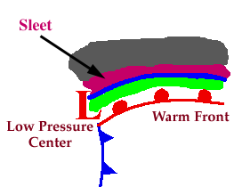
Progressing further ahead of the warm front, surface temperatures continue to decrease and the freezing rain eventually changes over to sleet. Areas of sleet are located on the colder side (typically north) of the freezing rain band.

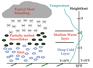
Sleet is less prevalent than freezing rain and is defined as frozen raindrops that bounce on impact with the ground or other objects. The diagram below shows a typical temperature profile for sleet with the red line indicating the atmosphere's temperature at any given altitude. The vertical line in the center of the diagram is the freezing line. Temperatures to the left of this line are below freezing, while temperatures to the right are above freezing.

Sleet is more difficult to forecast than freezing rain because it develops under more specialized atmospheric conditions. It is very similar to freezing rain in that it causes surfaces to become very slick, but is different because its easily visible.


Forecasting |
|

snow |


