|
At low levels, several air masses of distinctly different origin may be found in varying parts of the cyclone. The warm front marks the leading edge of warm moist air being pulled northward by southerly winds ahead (east) of the low.
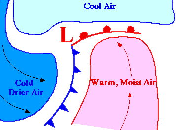
Clouds and precipitation usually develop along and ahead of the warm front as warm moist air rides up and over the colder air ahead of it.
|