|

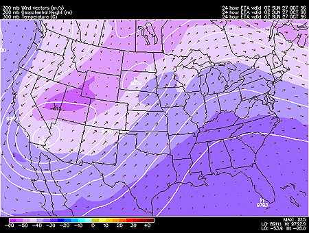
This panel shows 300 mb forecasted fields for geopotential height, temperature and wind vectors. 300 mb charts depict conditions in the upper troposphere (roughly 9000 meters) where most of the weather producing phenomena occur, otherwise known as the jet stream level.
Geopotential height approximates the actual height of a pressure surface above mean sea-level and is represented by the solid white contours. The geopotential height field is given in meters with an interval of 120 meters between height lines. The 300 mb height field encircling the globe consists of a series of troughs and ridges, which are the upper air counterparts of surface cyclones and anticyclones. The distance from trough to trough (or ridge to ridge) is known as the wavelength. Typically waves at 300mb are known as long wave. Embedded within the long waves are short waves, which are smaller disturbances often responsible for triggering surface cyclone development.
Wind vectors provide information about wind direction and wind speed and are drawn here as tiny red arrows. Wind vectors point towards the direction in which the wind is blowing and the longer the wind vector, the stronger the wind. The unit of magnitude for wind speed as depicted by the wind vectors is meters per second.
|
