|
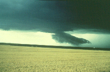
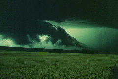
Researchers have shown that wall clouds probably develop when some rain-cooled air is pulled upward, along with the more buoyant air, as the strengthening updraft attempts to replace ever-growing volumes of rising air. The rain-cooled air is very humid, and upon being lifted it quickly saturates to form the lowered cloud base. Thus, the wall and tail cloud probably develop sometime after an intense supercell or multicell storm begins to precipitate.

Photograph by: Moller
Looking to the northwest, we see a detached scud cloud which had just emerged from the precipitation area and was moving rapidly southwestward (from right to left).

Photograph by: Moller |
About 5 minutes later, the scud cloud entered the updraft area and was lifted into the cloud base. This was the beginning of a wall and tail cloud that persisted for over 30 minutes. |
|
