|
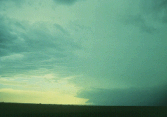
This is the first of four photographs of an approaching thunderstorm to help visualize the difference between gust front outflow "push" and wall cloud inflow "pull." To the distant west-southwest, note the suspicious cloud lowering at the south flank of an isolated severe thunderstorm. Is it a wall cloud or a portion of a shelf cloud?

Photograph by: Doswell
A subtle, but important clue is that the lowering slopes downward away from the rain area, rather than into the rain. This is the slope that a shelf cloud usually takes. As cold air is "pushed" out of the precipitation area by the downdraft, warm air slides up and over the gust front forming the concave-shaped shelf cloud.
|
