
|

The second satellite photo shows a huge anvil cloud arising from a large cluster of storms. This is called a mesoscale convective system or "MCS". An entire MCS cannot be viewed from the ground and in some cases not even by a single radar, so we use the satellite perspective. It is a group of multicell storms, often dominated by a vigorous squall line on the downwind (east) side and a number of weaker multicell cluster storms in the interior.
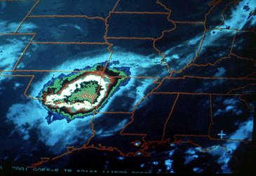
An MCS often will bring severe weather and heavy rain with the squall line, and additional heavy rainfall with the interior storms. A number of major flash floods have resulted from MCS passage, making this large storm complex an extremely important grouping of multicell thunderstorms to recognize.
|