
|

6.47 - 7.02 micrometers (upper level
water vapor) -
at 4 km, useful for
estimating regions of mid-level moisture content and advection plus tracking
mid-level atmospheric motions.
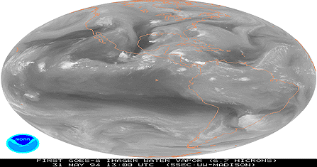
Image provided by GOES-8 Results (NASA-Goddard)
|
|
. |
Image provided by GOES-8 Results (NASA-Goddard)
|