
|


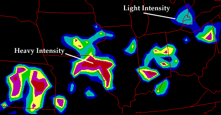
Manually Digitized Radar (MDR) images are low resolution radar depictions available from the National Weather Service. These images show the echo intensity in six categories. There also a number of symbols indicating precipitation type, cell movement, line movement, and echo coverage. Severe thunderstorm and tornado watches, line echo wave patterns, and hook echoes are also indicated. The height of cloud tops is also indicated in hundreds of feet above sea level. The figure below shows an example of an MDR image.
The table below summarizes the features of MDR images.
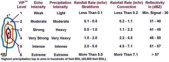
* The numbers representing the intensity level do not appear
on the chart. Beginning from the first contour line, bordering the area,
the intensity level is 1-2, second contour is 3-4, and third contour is 5-6.
** DVIP stands for Digital Video Integrater and Processor. Often DVIP is
represented by VIP.
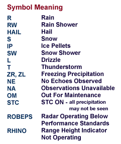 |
These symbols represent various types of precipitation and status conditions. |
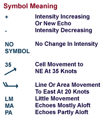 |
These symbols indicate speed and direction of movement, plus changes in echo intensity. |
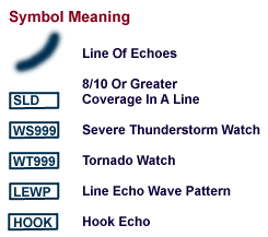 |
These symbols indicate severe weather conditions. |
|
wsr-88D |
|
bright band feature |