|
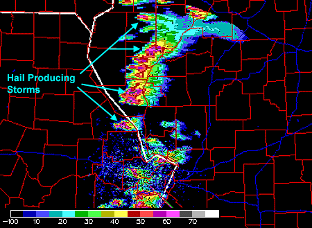
This image shows some severe thunderstorm cells in western Illinois and eastern Missouri on April 19, 1996. The small regions of high reflectivity (shades of purple and gray) located near the edges of these storms are likely to be regions where large hail is falling. Typically, radar reflectivities associated with hail have values exceeding 60 dBZ.


snow storms |
|

Satellites |


