
|


Viewed from the west, this late afternoon Kansas storm has subtle indications of being multicellular. Can you see the two major updraft areas? Note the dark, rain-free bases beneath each updraft, with a gap between the bases. You cannot always discern between storm types by visual observations. Radar usually is the best tool for that purpose, but in many cases the visual appearance will yield important clues.
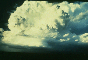
Photograph by Hoadley
This is the same storm (continued
from the multicell storm page) complex less
than one our later. The multicell
storm apparently has evolved into a
complex with one dominant updraft.
The storm has become a supercell; note
the rope-like tornado to the immediate
right of the sun-lit precipitation shaft.
The tornado is occurring beneath the updraft
on the storm's southwest flank, the most
likely location for supercell tornadoes.
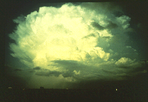
Photograph by Hoadley
The storms we have seen lead us to ask
several fundamental questions: What
environmental factors influence the type
or types of storms and the intensity of
severe weather that occur on a given day?
And why does a storm sometimes evolve from
one type to another?
|