
|


Squall lines and multicell storms occasionally develop the appearance of a "bow echo" on radar. When the bow shape opens toward the strong mid-level winds (10 to 20 thousand foot level winds of 40 knots or greater), there is an excellent chance that the strong mid-level currents have been transported to the ground in a downburst, forcing a portion of the squall line or multicell storm to accelerate forward. Macroburst and microburst winds are common with these storms, and 100+ MPH winds have been reported in extreme cases.
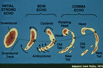
Weak to occasionally strong tornadoes may occur with the comma head, while gustnadoes may form on the strong bow echo gust front.
Photograph by: Doswell
This is a northward view of a gustnado, a tornado that develops on a thunderstorm gust front with marked across-front horizontal shear. Gustnadoes typically are weak and short-lived as tornadoes go, since they are not associated with an intense deeply rotating updraft. They are also nearly impossible to warn for, because of their seemingly random occurrence along the gust front.
The bow echo weakens as the accelerating downburst outruns the storm complex. Those who operate radar should be aware that the rotating comma head occasionally has deceptively weak radar reflectivity while producing damaging winds and tornadoes.
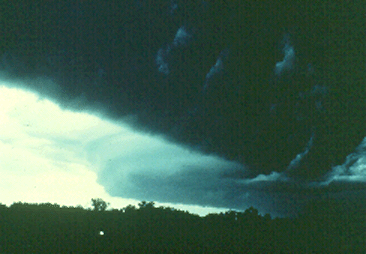
Photograph by: Moller
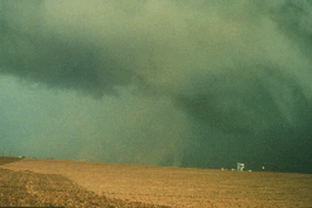
Smaller scale bow echoes frequently can be detected from visual observations. This southward view shows the underside of a right to left (eastward) moving storm's shelf cloud, with the southern extent of the complex bowing radically eastward in the background. Damaging winds and a radar bow echo occurred within this area.
We need to stress that it is not the job of spotters to detect and report bow echoes, but spotters should know what they are dealing with and what the main severe weather threats are if Weather Service personnel ask them to check out a bow echo complex.
|
bow echoes |
|
Supercells |