
|


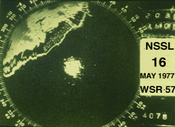
Radar indicates the linear nature of a squall line. The strongest radar reflectivity (VIP) levels on the leading edge reveal the locations of updrafts and adjacent regions of heavy precipitation.
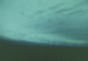
From the eastern plains of Colorado we see a distant, approaching squall line, about 20 miles to the west. Further east from the High Plains, we would be less likely to have this unrestricted view because of haze and intervening clouds.
Photograph by: Moller
Nevertheless, similar storm structure, with new updrafts developing on the leading edge of the gust front, will be present regardless of location.
|
retreating lines |
|
bow echoes |