
|


This rather innocuous appearing squall line probably is more typical in appearance than some of the spectacular squall lines we have been viewing. Note the subtle shelf cloud ahead of the dark precipitation area. This was a non-severe squall line in eastern Oklahoma in the fall, looking west from about 5 miles.
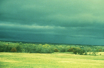
Photograph by: Doswell
Underneath the shelf cloud and looking north, note the change in appearance from the ragged, outflow-torn clouds to the smoother elements ahead of the line. The outflow winds had commenced at this time, and hail and heavy rain were to arrive in minutes.
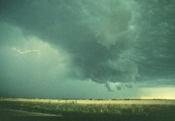
Photograph by: Moller
This strong gust front (shown below) was accompanied by 40 and 50 MPH winds and a shelf cloud with a highly-sloped concave shape to the underside.
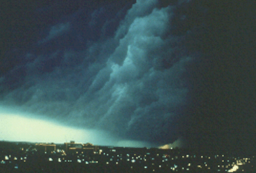
Photograph by: Moller
Near the light area on the southwest horizon, a downburst was resulting in damage at this time, as reported by Amateur Radio Spotters southwest of Fort Worth, Texas. The squall line was moving eastward (right to left).
|
on satellite images |
|
retreating lines |