
|


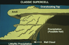
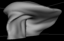
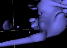
Supercells have a common structure, as can be seen by the left diagram below. Computer model visualizations (below right) can capture most of this structure.
|
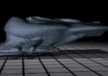 Image by NCSA/Wilhelmson
Click image for video (Must have RealPlayer G2) |
Click to explore VRML Storm (11MB). |
Click to explore VRML Storm. |
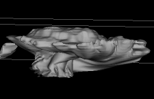
| Often, if you can see the whole storm, you can see a large dome above the central updraft and a broad, flat region covering the entire storm and extending downwind of the updraft. This is called the anvil, and both features show up well in this model. |
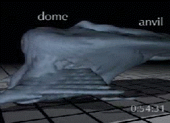
Image by NCSA/Wilhelmson |
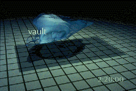
Image by NCSA/Wilhelmson | Another characteristic observable in both models and in nature is the large cloud free area above the base of the updraft known as the vault or Weak Echo Region. Rain and possibly hail fall to the ground outside this region, leaving the vault region relatively precipitation-free. |
| In some supercells, one can sometimes observe both a v-notch and a hook echo. In this modeled radar image, both are evident. A hook echo is a strong signal that a supercell thunderstorm is about to or already has produced a tornado. |
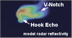
Image by NCSA/Wilhelmson |
Click for VRML flanking line | Some supercell thunderstorms also possess a clearly visible flanking line. The flanking line separates cool storm outflow from warm moist storm inflow and sits above the gust front. New storms form along the flanking line as the moist inflow air rises as it approaches the cool surface air. In this VRML environment, the blue body represents areas of significant cloud development with the flanking line very evident (foreground of image). |
| Weightless particles are used to trace the air motion within a supercell. Blue balls are sinking and orange balls are rising. |
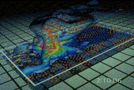
Image by NCSA/Wilhelmson |
|
introduction |
|
tornadoes |