
|


This small wall cloud, seen looking north-northwest from about 10 miles away, was moving south-southeast. At this time previously strong southeast winds had become near calm, and within several minutes the wind shifted to northerly. The wall cloud clearly was undercut by outflow.
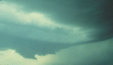
Photograph by: Moller
About 10 minutes later, the same wall cloud was in the process of dissipating on the right side of the photograph. A second and equally small, unimpressive wall cloud was developing due southwest, or to the left of the first wall cloud. The second wall cloud also lasted less than 10 minutes. Once again significant rotation was not observed.
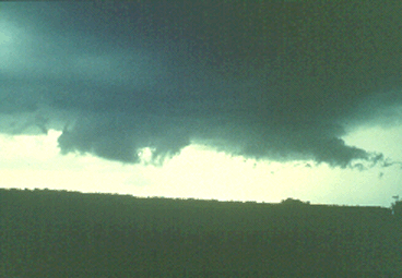
Photograph by: Moller
The quick dissipation and redevelopment of these wall clouds are suggestive of a multicell or non-tornadic supercell storm. This storm did produce sporadic hail up to golf ball size and a brief gustnado along the flanking line, but no significant tornadoes.
|
short-lived |
|
with rotation |