
|


The storm continued to grow, and assumed an extremely impressive appearance. We are looking northeast from about 20 miles.
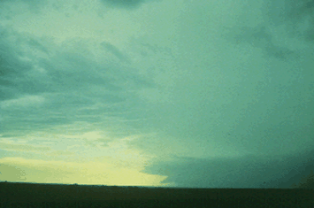
Photograph by: NSSL
Was the storm really a supercell? Doppler Radar confirmed a mesocyclone. A storm chase team, looking northwest from about 10 miles, took this photograph. Note the circular banding wrapping around the low levels of the updraft.
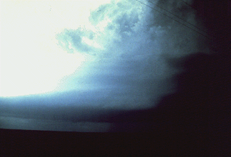
Photograph by: NSSL
Again, this is visually suggestive of the rotation that Doppler Radar was indicating. The storm produced large hail and at least one tornado after this photograph was taken.
|
supercell lt-analysis |
|
Wind Shear |