
|


On satellite images, a midlatitude cyclone is often identifiable by a comma-shaped cloud mass.
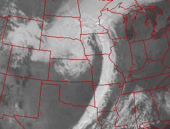
This visible satellite image
shows how a single cyclone
can influence the
weather over a large area, (in this case from Texas into
Minnesota).
This particular storm left more than six inches of snow from Nebraska
into Minnesota, while brief yet heavy rains occurred from
Missouri into Texas.
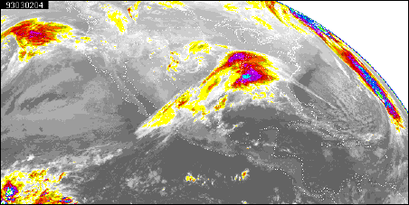
MOVIE (QuickTime 1.3MB): Infrared Satellite Loop
Here is a movie loop of
color enhanced infrared
images spanning 18 hours. The center of the
cyclone was initially located over the southcentral portions of the
United States.
As the cyclone evolved over time, notice the counterclockwise rotation
of clouds around the cyclone center.
|