
|


Clouds are not the only indication of moisture in the atmosphere. In the visible satellite image below, there was considerable cloudiness associated with stormy activity over the the Eastern United States (circled in blue), while clear skies dominated the Southern Plains (circled in red).
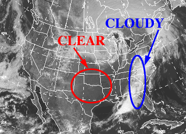
Now compare this image to the water vapor image for the same time. Bright white areas indicate higher amounts of moisture while darker areas indicate lesser amounts. The pronounced white areas in the water vapor image correlate almost exactly with the clouds circled above (in blue). However, the water vapor image indicates relatively high concentrations of moisture across the Southern Plains, while this same region appears cloud-free in the visible image. This is an example of water being transported through the atmosphere in its vapor form.
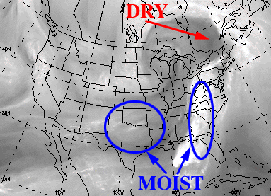
The area in the Southern Plains is not as bright as the area of clouds located in the Eastern U.S. because the clouds contain more water. Also observe that there is no black on this image, signifying the presence of at least small amounts of water vapor everywhere!
|
introduction |
|
Hydrologic Cycle |