
|


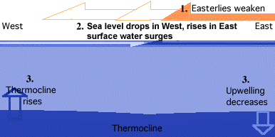
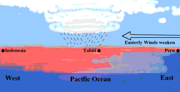
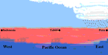
The easterly trade winds are driven by a surface pressure pattern of higher pressure in the eastern Pacific and lower pressure in the west. When this pressure gradient weakens, so do the trade winds. The weakened trade winds allow warmer water from the western Pacific to surge eastward, so the sea level flattens out.
This leads to a build up of warm surface water and a sinking of the thermocline in the eastern Pacific. The deeper thermocline limits the amount of nutrient-rich deep water tapped by upwelling processes. These nutrients are vital for sustaining the large fish populations normally found in the region and any reduction in the supply of nutrients means a reduction in the fish population.
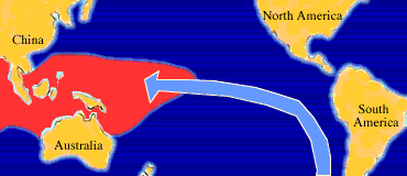
Convective clouds and heavy rains are fueled by increased buoyancy of the lower atmosphere resulting from heating by the warmer waters below. As the warmer water shifts eastward, so do the clouds and thunderstorms associated with it, resulting in dry conditions in Indonesia and Australia while more flood-like conditions exist in Peru and Ecuador.
El Niño causes all sorts of unusual weather, sometimes bringing rain to coastal deserts of South America which never see rain during non-El Niño years. The flooding results in swarming mosquitoes and the spread of disease.
The air-sea interaction that occur during an El Niño event feed off of each other. As the pressure falls in the east and rises in the west, the surface pressure gradient is reduced and the trade winds weaken. This allows more warm surface water to flow eastward, which brings with it more rain, which leads to a further decrease of pressure in the east because the latent heat of condensation warms the air...and the cycle continues.
|
non el nino years |
|
sea surface temps |