|
High level clouds typically form above 20000 feet (6000 meters) and since the temperatures are so cold at such high elevations, these clouds are primarily composed of ice crystals. They are typically thin and white in appearance, however during sunrise and sunset, these clouds can appear in a magnificent array of colors as unscattered components of sunlight (red, yellow, and orange) are reflected by the underside of the clouds.
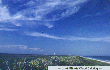
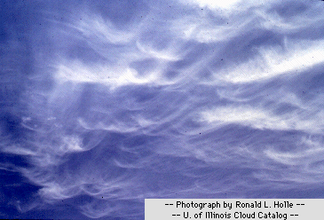
The most common variation of high level clouds are cirrus clouds. Cirrus are thin, whispy clouds composed of ice crystals that originate from the freezing of supercooled water droplets and exist where temperatures are below -38 degrees Celsius. Cirrus generally occur in fair weather and move from west to east, pointing in the direction of the prevailing winds at their elevation.

Cirrus can form from almost any cloud that has undergone
glaciation and can be observed
in a variety of shapes and
sizes. Possibilities range from the "finger-like" appearance of cirrus
fall streaks, commonly seen during pleasant weather conditions,
to the uniform texture of more
extensive cirrus clouds
associated with an approaching warm front.

Fall streaks form when snowflakes and ice crystals
fall from cirrus clouds. The change in wind with height and
how quickly these ice crystals actually fall determine the shapes
and sizes the fall streaks attain. Since ice crystals fall much
more slowly than rain drops - about 1 meter per second
compared with about 8 meters per second for large raindrops -
fall streaks tend to be stretched out horizontally as well as vertically.
|


